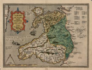
This is the first map that shows Wales as a separate country. It was drawn by Humphrey Llwyd from Henllan who studied at Oxford before working with a Flemish cartographer. Although the map has many inaccuracies it was in use until 1741.
Blog articles will only appear in the language they are provided in by the author.
Yn yr iaith y’u hysgrifennwyd gan yr awdur yn unig y bydd yr erthyglau blog yn ymddangos.


